
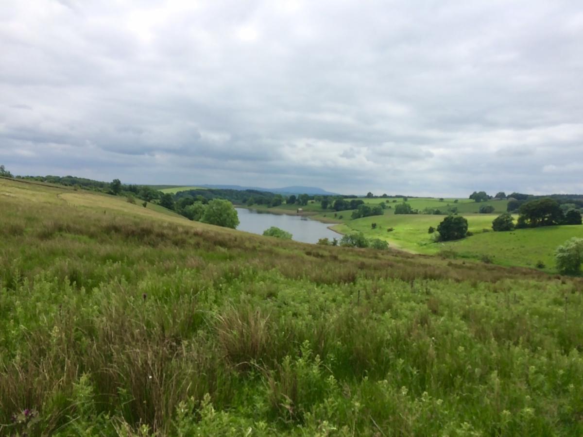
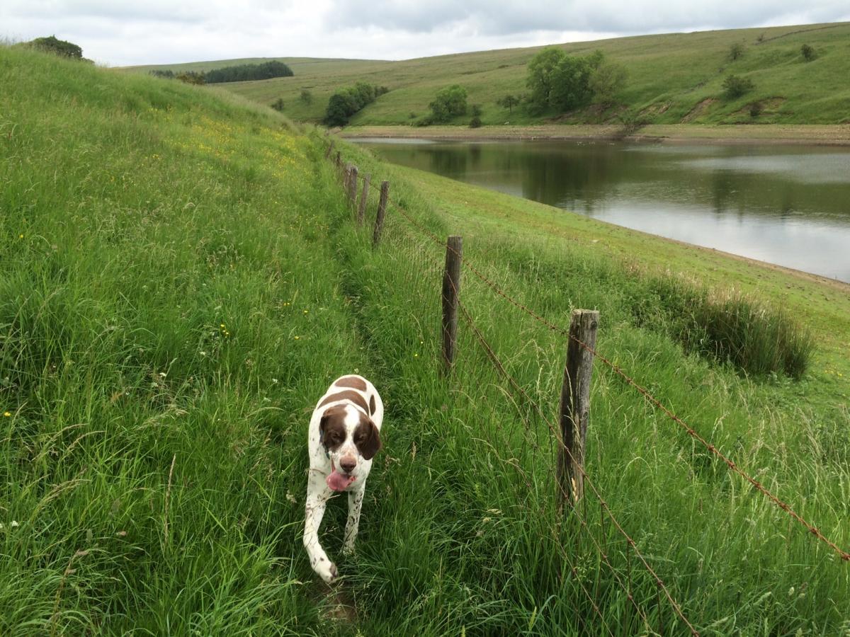
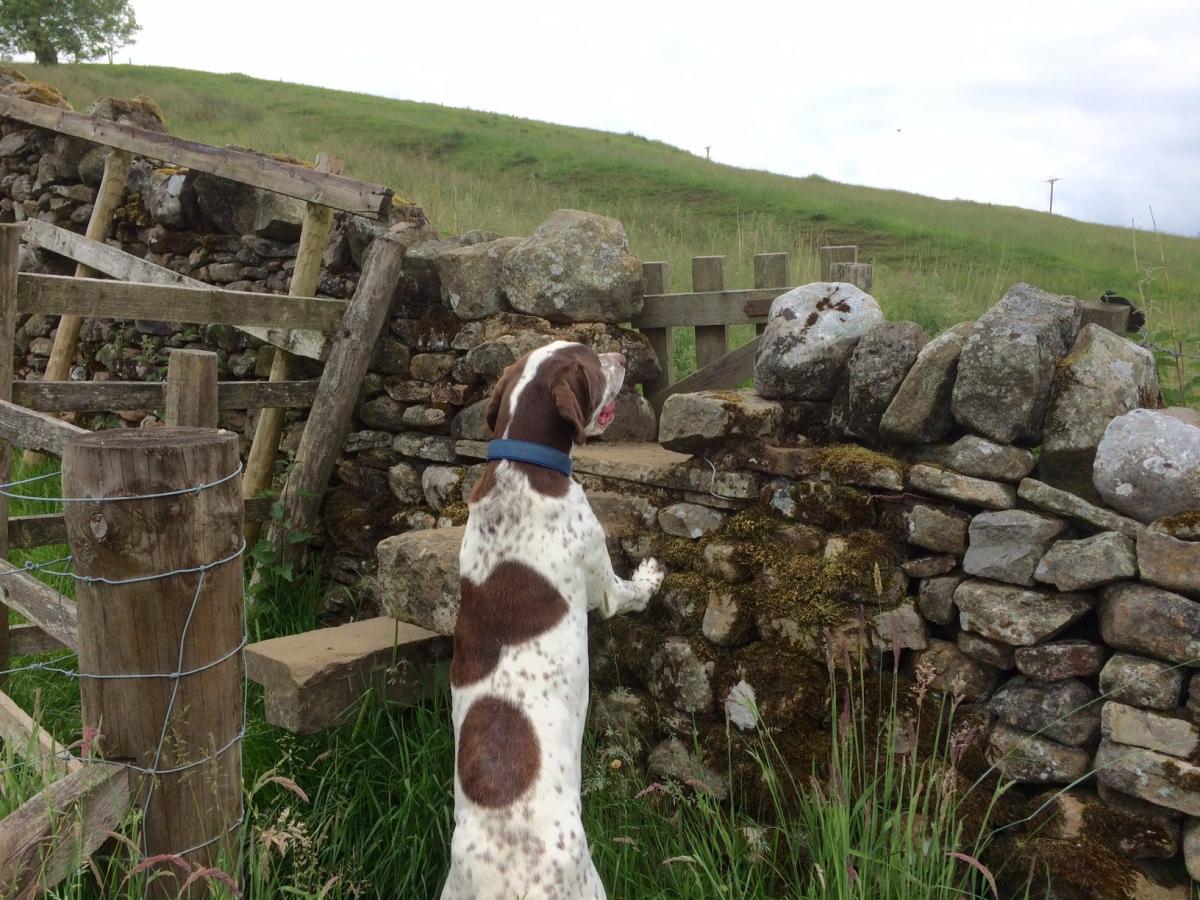
I AM indebted to Allan Friswell, of Silsden Strolls, for this walk from Winterburn- which I have adapted it a bit. It sets off from the delightful hamlet of Winterburn before heading up to the reservoir. The route then goes along just one side of the reservoir before heading off onto moorland, with some wonderful far distant views of Sharp Haw and Rylstone Cross, and my old favourite, the seemingly ever present Pendle Hill. If you are taking a dog with you, do remember to keep it under control, or on a lead, there is an abundance of sheep and cattle about, and also pheasants and other ground nesting birds.
Step by step
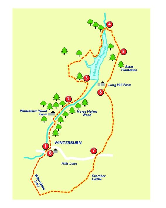
1 From Winterburn take the dead end road from the centre of the village, passing a farm on right, over cattle grid.
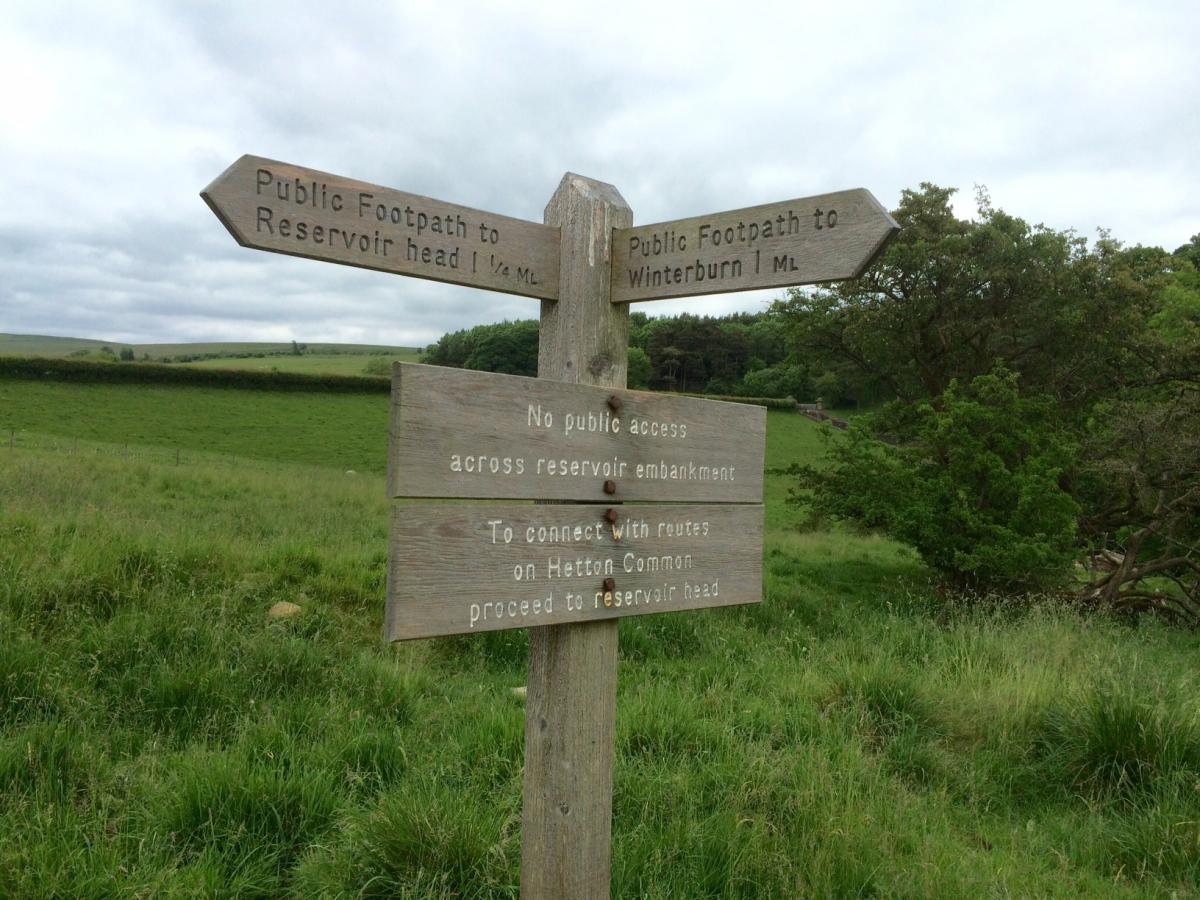
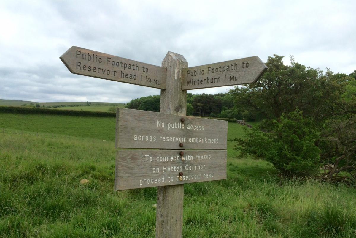
2 Remain on the narrow surfaced road as it winds its way along with a beck and lovely, dense woodland on right. At the reservoir keeper's house, go left, following the path marked Reservoir Head.
3 Off to your right you will be able to see the reservoir dam. Continue along as the farm track goes through gates and bears to right. Just before Way Gill Farm, take footpath to right, cross field and through gate, and go sharp right, following the boundary of the field, down to the reservoir. Go over stile and turn left onto track. Continue along track as it starts to go around to right, over cattle grid and then take the re-directed footpath, just ahead of farmhouse, over stone stile into field. Keep to right hand boundary of field - being careful of steep drop down to beck - to meet fenced off reservoir. Follow path, as it turns left along edge of fence, with reservoir on your right. Continue along the path, and through a couple of gates, across a wooden plank footbridge and leave the side of the reservoir, crossing a substantial Victorian arch bridge, which goes across Hetton Common Beck.
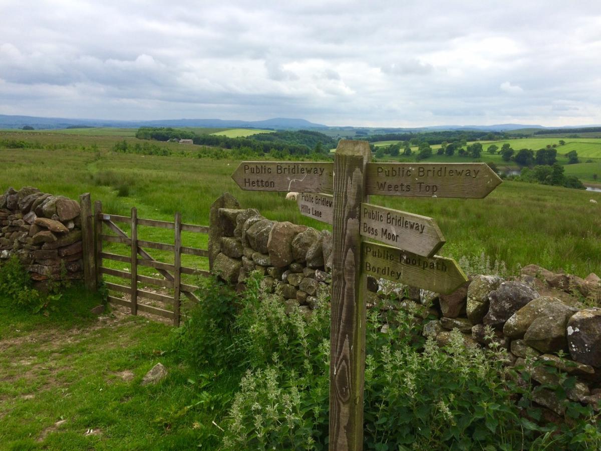
4 Follow the path uphill and then follow path marked Hetton. The path crosses moorland, and over to right you have a lovely view of the reservoir.
5 Path eventually comes to a gate, take the bridlepath -leaving Moor Lane - marked Hills Lane. Follow the path, which has a couple of waymarkers to show your way. You will pass a farm on right, continue through gate, and keep close to wall on right and head for another gate.
6 Just ahead of you, over to right, is the substantial house 'Aquilla'. Go through another gate and folllow path, which bears off slightly to the left keep to the path and through a gate, then follow a sunken path, with wall on left. You eventually come to a gate which goes out onto Hills Lane - you can turn right here, which will get you back to Winterburn more quickly.
7 Otherwise, cross over road and take the bridlepath opposite, signed Friars Head. Drop down hill, with wall on left, over stile, passing barn on left, and on to gate. Stick to signed bridlepath. Cross field, with wall on right. Through metal gate and then bear right - the path loses its way here a bit, but you want to head over towards a wall on the right. Go downhill to Friars Head farm. Through gate and turn right onto Winterburn Lane, which takes you back into the village.
Factfile:
Location: Yorkshire Dales National Park
Start/finish: Winterburn.
Distance: Six miles, allow three hours
Difficulty level: Easy, with a couple of short climbs.
Terrain: Surfaced, but very quiet roads, fields, tracks and moorland
Refreshments: None on route, excellent and frequent picnic spots though


Comments: Our rules
We want our comments to be a lively and valuable part of our community - a place where readers can debate and engage with the most important local issues. The ability to comment on our stories is a privilege, not a right, however, and that privilege may be withdrawn if it is abused or misused.
Please report any comments that break our rules.
Read the rules here