
Jonathan Smith runs Where2walk, a walking company in the Yorkshire Dales. Jonathan has written his own book, the Dales 30 which details the highest mountains in the Dales. He also runs one-day navigation courses for beginners and intermediates. Join his Learn a Skill, Climb a Hill weekends in the Dales. To find out more details on any of the above visit his website, where2walk.co.uk
NEAR Ribblehead and on the lower slopes of Whernside is one of the finest areas of limestone pavements in the Yorkshire Dales. There are wonderful views over two of the Three Peaks and a photographer’s delight.
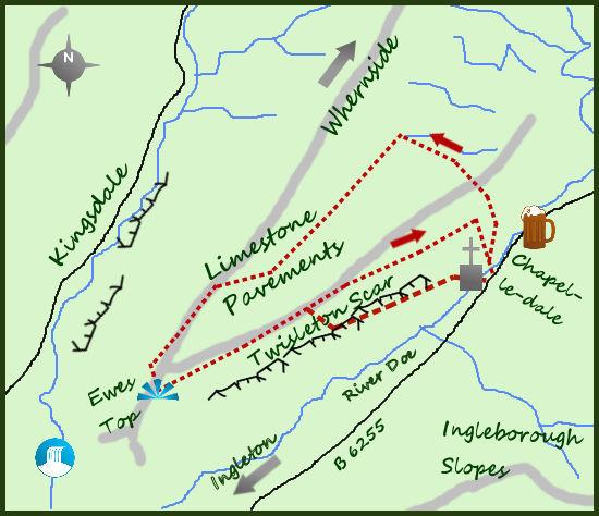
The start of the walk is in the small hamlet of Chapel-le-Dale, midway between Ingleton and Ribblehead. There is a small number of houses in the hamlet, but the main attraction is the small but attractive Norman Church of St Leonard.
The graveyard was used to bury many of the ‘victims’ of the brutal construction conditions when the Ribblehead viaduct was built.
The viaduct is magnificent but it would be wrong not to acknowledge how ‘navies’ lived in between 1869 and 1875, more than 200 died from both accidents and smallpox.
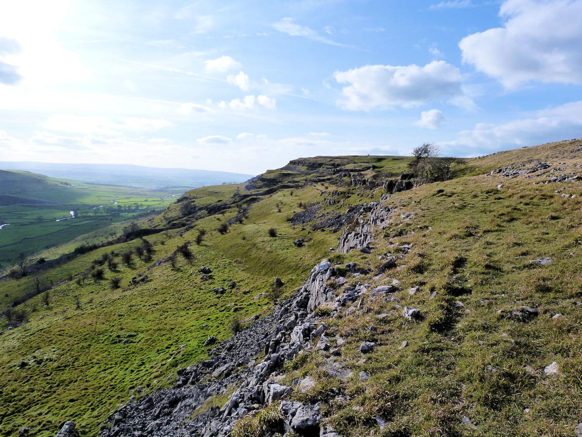
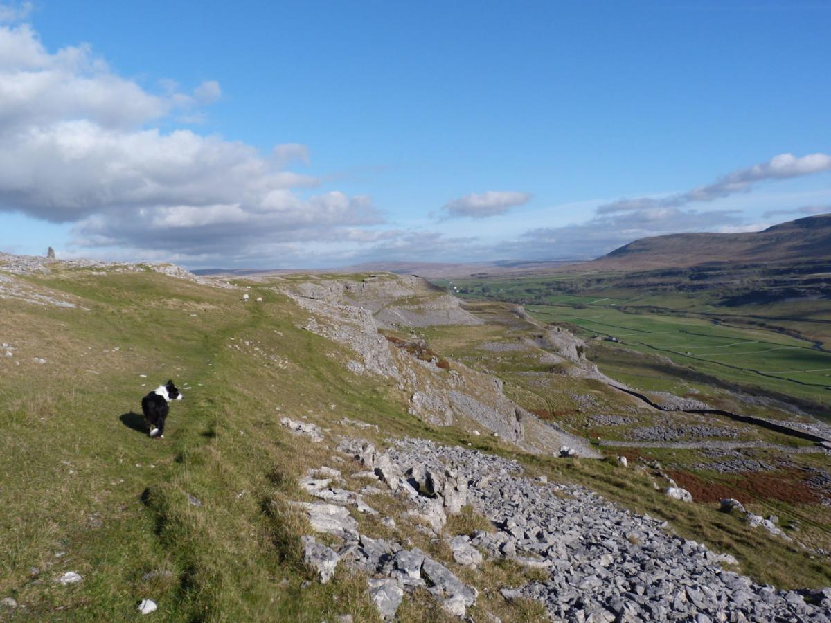
Start the walk by heading up hill on the road for a few metres until it turns in to a track which climbs steadily alongside a small stream to the farm and old quarry at Gill Head. Continue climbing along the lane (part of both the Pennine Journey and Pennine Bridleway long distance paths) through a gate to Ellerbeck Gill. You are now midway down the broad shoulder leading from the summit of Whernside to Ingleton. Turn left and head on the downhill path towards Ingleton. After ¾ a mile the grassy, moorland surroundings become interspersed with areas of limestone rock, the start of the limestone pavements. Keep walking for further half mile, the best of the pavements are to your right.
The limestone bedrock of this entire area was formed millions of years ago when the whole area was a tropical sea and dead marine life sank and solidified. The rock became exposed 15,000 years ago when the glaciers were retreating after the last ice age. Since then acid in the rain has created the distinctive look of the rock, the pavement effect where cracks have widened and eroded leaving blocks of solid rock. After a mile of walking through the areas of pavement there are some large boulder rocks. These are of harder granite and have been carried along by the glaciers and dumped on the limestone. They are known as erratics. A large one near the boundary on your right signifies the time to leave the path and head left towards Ingleborough. There are no better views of this fine mountain than here.
On crossing the shoulder soon reach the sharp edge of Twisleton, turn left to return. There is a wall alongside the top of the steep scar. From here there is a choice of return. Either stick to the wall at the top of the scar for one and a half miles and join the track leading in to High Scales farm, or drop down a suitable place on the scar and return to Chapel-le-Dale by contouring the slopes of the scar.
There are many gaps in the dry stone walls to walk through and it is great fun to pick your way through the exposed rock. All the walking is on access land until meeting the minor road near Chapel-le-Dale so simply avoid climbing any walls and enjoy the walk.
Fact Box:
Distance: Roughly 6 miles
Height to Climb: 170m (560 feet).
Start: SD 738722. There is some parking on the small rad leading in to Chapel-le-Dale.
Difficulty: Medium. When wet the limestone rock can be very slippy to walk on.
Refreshments: The Old Hill Inn is on the main road at Chapel-le-Dale.
Be Prepared:
The route description and sketch map only provide a guide to the walk. You must take out and be able to read a map (O/S Explorer OL2) and in cloudy/misty conditions a compass. You must also wear the correct clothing and footwear for the outdoors. Whilst every effort is made to provide accurate information, walkers head out at their own risk.
Please observe the Countryside Code and park sensibly.


Comments: Our rules
We want our comments to be a lively and valuable part of our community - a place where readers can debate and engage with the most important local issues. The ability to comment on our stories is a privilege, not a right, however, and that privilege may be withdrawn if it is abused or misused.
Please report any comments that break our rules.
Read the rules here