
Jonathan Smith runs Where2walk, a walking company in the Yorkshire Dales.
Jonathan has written his own book, the Dales 30 which details the highest mountains in the Dales.
He also runs one-day navigation courses for beginners and intermediates. Join his Learn a Skill, Climb a Hill weekends in the Dales.
To find out more details on any of the above visit his website, where2walk.co.uk
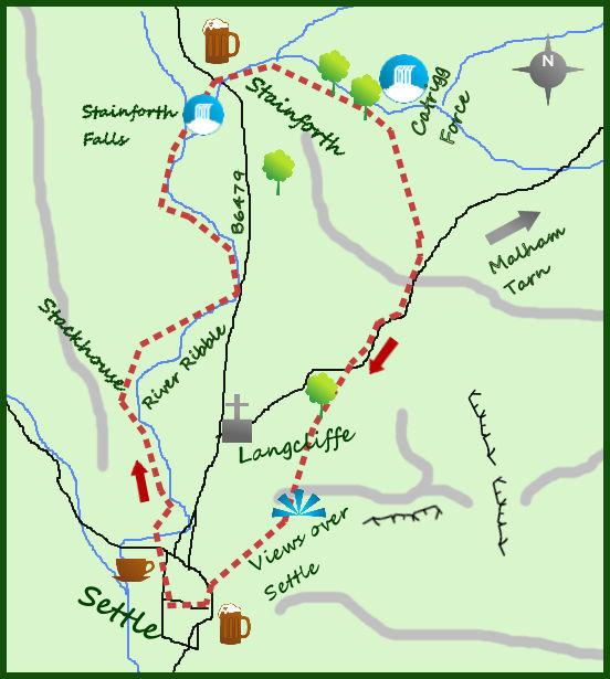
STARTING out by walking the banks of the River Ribble from Settle the route climbs steeply, but briefly from Stainforth before through limestone scenery with spectacular views over the dale. Go soon and watch the salmon jumping.
Park in the market town of Settle and cross the road bridge in to the neighbouring village of Giggleswick. Just before the swimming pool a narrow path heads north and after 100 metres arrives at the river. Turn left and next to the playing fields go through a stile and head across a field towards some woods. The path then passes a farm on the left, crosses a 2nd field and enters the attractive village of Stackhouse.
The village originally grew up for the mill workers at nearby Langcliffe Mill.
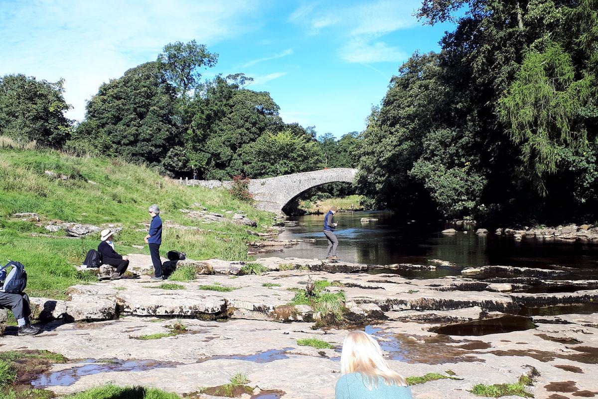
At the weather stone on the main road through Stackhouse head for the river. On the other side of the river lies the cotton mill of Langcliffe High Mill, built in 1783. It was one of the largest and most advanced mills of its time and along with Watershed Mill half a mile down river produced a lot of cotton. Look for the water wheel and pumping equipment over the bridge; now it is owned by a packaging company. Don’t cross the bridge but turn left and sticking close to the river follow the path for over a mile to Stainforth Falls. This riverside path can be muddy at times and has a couple of awkward stile but in other ways is extremely pleasant.
On arrival at Stainforth Falls (next to a large static caravan site of Little Stainforth) take a seat on the rocks and start looking out for the salmon. It is one of the best places to watch them jump. Follow this by crossing the river at the pack horse bridge just north of the falls and follow this up in to the village of Stainforth, emerging at the car park under a bridge. There are toilets here. Pick your way through Stainforth, (the church is worth a visit) and take the road opposite the Craven Heifer pub. Turn left where the road ends and exit the village on a wide track heading east.
The track climbs, initially steeply but soon easing, for three quarters of a mile. Just before a gate there is a small path leading off to the left which drops to Catrigg Force. Hidden in some woodland this is a lovely waterfall, a double fall of water and a hidden gem.
Return to the gate then follow the farm track across an open field then on to a tarmac road. Turn right and follow this quiet and very pretty road through some lovely limestone scenery for nearly a mile to a sharp right turn. Take the footpath opposite the bend and follow the path for 1 mile till it drops in to Settle.
The views in this last mile are outstanding with the path perched high above the dale below.
Distance: Roughly seven miles
Height to Climb: 260m (850 feet)
Start: SD 816637 Ashfield car park is set behind the market square in Settle.
Difficulty: Medium. A steep climb from Stainforth and some awkward stile contrast with the easy walking elsewhere.
Eat and Drink: Plenty of choice for places to eat and drink in Settle
Be Prepared:
The route description and sketch map only provide a guide to the walk. You must take out and be able to read a map (O/S Explorer OL2) and in cloudy/misty conditions a compass (essential on this walk). You must also wear the correct clothing and footwear for the outdoors. Whilst every effort is made to provide accurate information, walkers head out at their own risk.
Please observe the Countryside Code and park sensibly.


Comments: Our rules
We want our comments to be a lively and valuable part of our community - a place where readers can debate and engage with the most important local issues. The ability to comment on our stories is a privilege, not a right, however, and that privilege may be withdrawn if it is abused or misused.
Please report any comments that break our rules.
Read the rules here