
Straddling the Pennines, this walk sweeps through the moorland which was an inspiration for the famous Bronte sisters, Charlotte, Emily and Anne
THIS week’s walk takes us into Bronte country.
It starts at Penistone Hill Country Park, just a stone’s throw away from the village of Haworth, where the Bronte sisters made their home after their father, Patrick, was appointed curate.
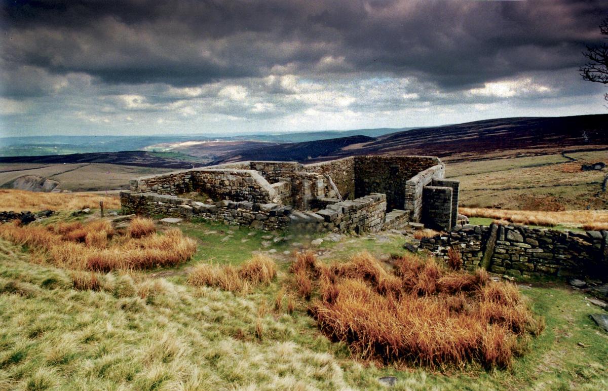
The paths and tracks on this route provide views up to Top Withens ruins, connected locally to Emily’s famous novel Wuthering Heights and the surrounding moors.
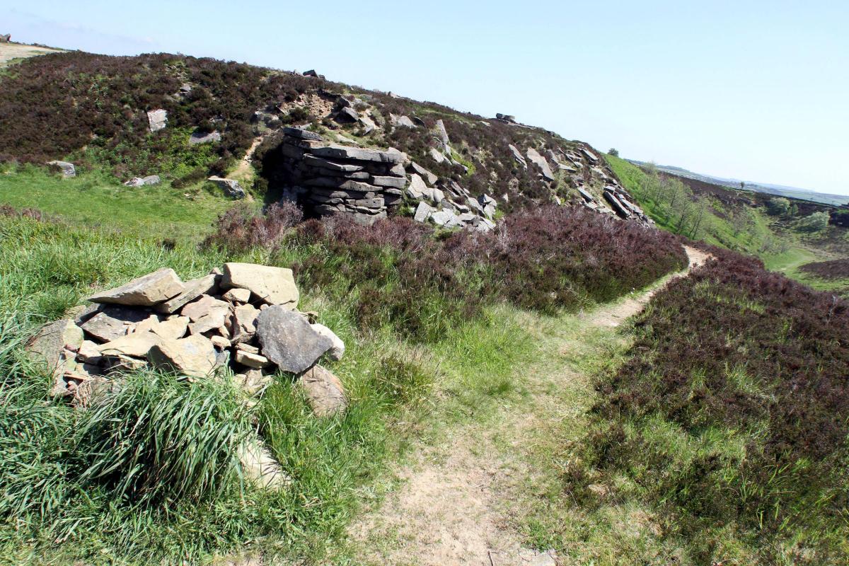
Sections can be quite wet and muddy and suitable footwear is advisable.
The walk has been provided by Yorkshire Water and other walks in the area can be found at yorkshirewater.com/walks-and-leisure
Step by step
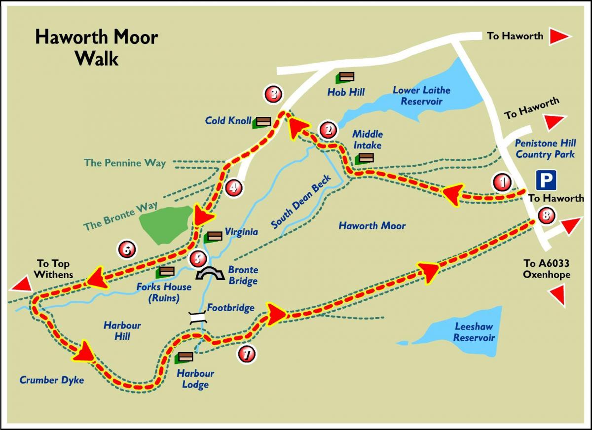
1. Start at the western edge of Penistone Hill Country Park at the car park. Turn right out of the car park, walking uphill for 25 metres, until you reach Tom Stell’s Seat on the right hand side. On the opposite side of the road, look for the footpath sign pointing on to the moor near the highest point on the road. Go through the gate and follow the path which crosses the moor diagonally to the right. The first part of this track can be very wet. Eventually, at the top of a rise, the path joins a broad track following the moor boundary wall. Turn left along track, walk on passing Middle Intake Farm on right. Thirty metres beyond the farm, turn right at the wall corner and drop down to cross a ladder stile. Continue forward down the right hand edge of the field until you are about two-thirds of the way down, turn half-left and head for the ladder stile in the bottom left-hand corner. Cross the stile and follow the path down to the bridge.
2. From the bridge, the path can be very wet and some of the logs are unstable. Walk forward to the wall and climb the steps to the field. The route slants slightly leftwards and climbs steeply. Cross the remains of an old wall and continue ahead up the path to a prominent stile in the next fence. Beyond this, aim at the building ahead to come out on to Back Lane via steps in the wall.
3. Turn left along the lane and where the lane divides take the right fork uphill to a gate and cattle grid. The lane now divides into three.
4. Take the left-hand track signed Bronte Falls. Shortly, this brings you to a field gate with a wicket gate at the side. Go through and forward to a signpost and ladder stile. Beyond the stile the route bears half left down the slope to the ruined barn at Virginia.
5. Turn right by the front corner of the barn and walk along the hillside following the path signed Top Withens. Continue forward on this obvious path and pass through three old walls to the site of an old farm just below the path. Go through the next wall and continue through three more fields to a ladder stile on to the open moor near the ruins of Forks House.
6. Go forward approximately half a mile to the next old wall across the path line. Twenty metres beyond this is a signpost and the path you are on continues upwards towards Top Withens, which is visible on the skyline ahead. If you’d like to visit the site which, it is believed, inspired the location of Wuthering Heights in Emily Bronte’s novel stay on the path and return to this point - the round trip should take 30 to 45 minutes. If you haven’t visited Top Withens, turn left at the sign, or else fork left and go down the banking. Cross the first stream (South Dean Beck) and then cross to the east bank of the tributary (Crumber Dike). Take the path which climbs from the junction of the streams, along the edge of the moor with the drop down to Crumber Dike immediately on your right. The path is narrow, but easy enough to follow. The path curves left for 600-700 metres around the bottom of Harbour Hill and to the house at Harbour Lodge. Here the walk follows the northern boundary wall, keeping the house on your right. Continue down the slope to a signpost and footbridge. Cross the stream and turn right to the next signpost on the access track to Harbour Lodge.
7. Turn left and follow the track for about one-and-a-half miles back to the public road, where you turn left back to the Penistone Hill car park.
Fact File
Start: Penistone Hill Country Park
Distance: 4.8 miles
Difficulty: Route requires good compass reading skills. Walking boots, food and drink and appropriate clothing and waterproofs are essential.
OS Map: Explorer OL21


Comments: Our rules
We want our comments to be a lively and valuable part of our community - a place where readers can debate and engage with the most important local issues. The ability to comment on our stories is a privilege, not a right, however, and that privilege may be withdrawn if it is abused or misused.
Please report any comments that break our rules.
Read the rules here