
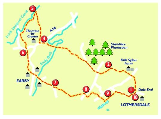
I'VE come across some interesting people while walking the Pennine Way, but the sight of a man 'off-roading' on a Honda Cub C9O motorbike, complete with full faring and windshield - bearing the Back British Farming sticker - was something completely new. Farmer, Denis, was scouting for moles on his wife's farm in Lothersdale, and was indeed, a sight to behold. Stopping for a chat, Denis explained he had been to the Isle of Man races three times on his bike, and had on one occasion, even ridden the course. Everyone should have a Honda Cub, he enthused, explaining it coped with the rough terrain of the Lothersdale countryside as ably as any main road. This walk, which starts and finishes in Lothersdale, is a long one, but very rewarding. It follows a large section of the Pennine Way, and also picks up a section of the Leeds and Liverpool Canal, and takes in Earby, Lothersdale and Thornton-in-Craven.
1 From Raygill Fisheries in Lothersdale, where there is on-street parking, walk back into the village, passing the school and just past the Hare and Hounds Pub, on the right, take the path on the left, marked Pennine Way, White Hill Lane, three quarters of a mile. Follow the path along a walled lane and through a farm gate, leave the farm track, and continue along Pennine Way, which climbs uphill. Following the fence line, steadily up hill, crossing stiles and a narrow road. Follow the well marked path to the trig point at Pinhaw Beacon.
2 From Pinhaw, stay on the Pennine Way, as it goes down to the road, crosses over road and continues for a short way before going off to left onto moorland - signposted Thornton in Craven. There are quite a few footpaths heading off from the Pennine Way, here, but stick to it, doing your best to get through what can be very muddy.
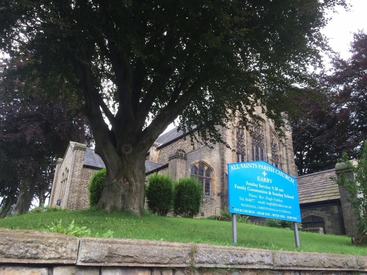
3 Cross over the wooden footbridge, still marked Pennine Way, and into field, keeping to left side boundary, and down to gate. Through gate and follow path downhill. Follow the power lines down to Brown House Farm. Turn right here, leaving farm and out onto minor road, passing left, under old quarry railway bridge. Follow narrow road up to the main A56. Cross over - still on Pennine Way onto Cam Lane.
4 Continue along Cam Lane, as it passes cottages and onto a farm track and continue along path to join Leeds and Liverpool canal.
5 Turn left on towpath, leaving the Pennine Way. Continue along the towpath until it reaches the road. Turn left for a short distance, and then take the footpath, just before a new barn conversion. Cross over a field and wooden footbridge, and over more fields, following path to St Mary's Church, Thornton-in-Craven.
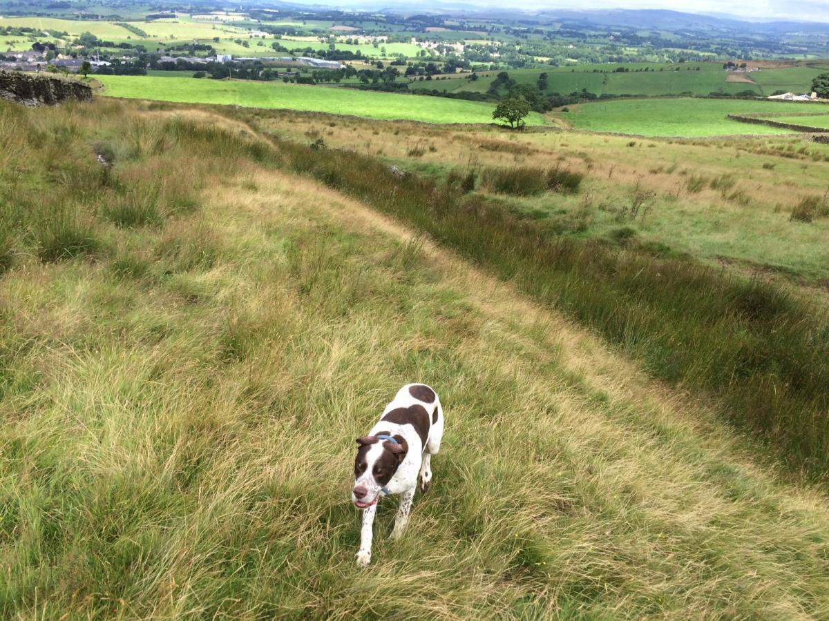
6 Enter the churchyard, through metal gate in wall, and exit church onto road, cross over road and take footpath opposite, heading towards Thornton Hall Farm Country Park. Follow the path, through the car park and out into fields, continuing along until coming out behind All Saints Parish Church, Earby. Cross over A56 and join School Lane, cross over beck and continue along road, which passes semi-derelict factory and under an old enclosed corridor which passes over road. At mini-roundabout, take second exit onto Water Street and continue for quite a way up hill onto Stoney Bank Road.
7 Where the road goes off to the right, look out for the footpath sign on the left of the road, and follow the track towards cottages. Before you reach the cottages and ahead of a footpath sign, go right up a driveway towards a house, passing next to it and joining a walled grassy path, passing stone trough on left. Keep on track as it comes out onto pasture, keep straight ahead, keeping stone wall on right and ignoring ladder stile, also on right.
8 Stay on the well defined path and head towards the radio mast, you will eventually come out onto a road, turn left and head uphill towards the mast.Just before the mast, take the footpath to the right and follow the farm track down towards the farm buildings. Where the track continues right towards the farm, head straight, and over fallen down wall and continue downhill towards another farm. Cross over wall stile and treading very carefully - there was a chicken pen here when I did it - continue out onto minor road, turn left and then right, following path, into field. Go down towards road.
9 Cross the road and through farm gate, following track down to farm, follow track through farm, out onto road, turn left and back to Raygill Fisheries.
Factfile
Area: Craven
Distance: 12 miles, allow at least four hours
Level of difficulty: Easy enough for most of the way, but with some steep climbs
Parking: In Lothersdale
Gates: Easy enough, although may cause some difficulty for larger, less mobile dogs.
Terrain: Moorland, tracks, roads and towpath
Livestock: Abundant, keep dogs well under control
OS Map: OL 21
Refreshments: Lothersdale, Earby


Comments: Our rules
We want our comments to be a lively and valuable part of our community - a place where readers can debate and engage with the most important local issues. The ability to comment on our stories is a privilege, not a right, however, and that privilege may be withdrawn if it is abused or misused.
Please report any comments that break our rules.
Read the rules here