

THIS walk starts at Scar House Dam, which was completed in 1936.
It is reached via Yorkshire Water’s private access road from the Lofthouse to Middlesmoor Road approximately 100 metres from Lofthouse village.
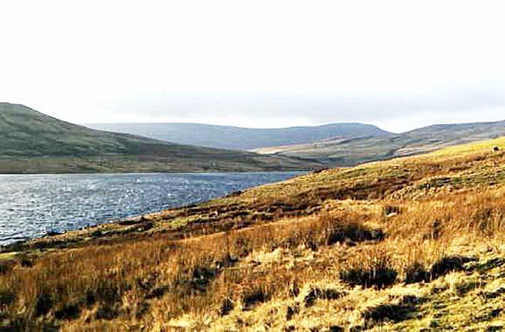
The dam is a feat of engineering - it contains more than one million tonnes of masonry, is 71 metres (233ft) high and is almost 600 metres long.
This walk itself crosses open moorland to the ridge between Great Whernside and Little Whernside and returns via the summit of Little Whernside from where on a clear day there are panoramic views over the Yorkshire Dales.
However, it is not a walk that should be attempted in mist or low cloud.
Walkers are also recommended to have boots, appropriate clothing, drinks, food, a map and compass - and the knowledge of how to use them.
Also extra care is needed as some of the paths and roads are shared with vehicles.
For more walks on Yorkshire Water land, visit yorkshirewater.com/walks-and-leisure.
Step by step 1. Leave the car park at Scar House and cross the dam. At the northern end take the track that runs parallel to the north shore of the reservoir through rough pastures.
2. Continue on this track past the ruined hamlet of Lodge to a T junction in the track.
3. Turn left and immediately right through a metal motorcycle barrier with a gate behind into rough pasture. Keep parallel to the wall on the right, until the path, shown as a Byway on the OS map to where it crosses the ridge, crosses another wall at a derelict gateway. Bear slightly left through another gateway and cross two streams in quick succession. The path follows the contour to a wall with a gateway in it. From here the route climbs steadily to the point where it crosses the ridge between Great and Little Whernside. This section can be very wet and boggy so please take care.
4. Turn right almost completely back on yourself to walk north-east along the ridge, with the views improving with every metre of height gained to the summit of Little Whernside.
5. The summit of Little Whernside consists of deep peat hags which make it very difficult to walk in a straight line. The ground can also be very boggy, Keep the wall/fence over the summit in view on the left. The ridge falls away steeply after the summit and the peat is left behind. Follow the path, keeping the wall on your left down to where the route meets a track at right angles by a gate.
6. Turn right down this track back to the T junction near Lodge at point 3. From here turn left and retrace the outward route back to the car park.
An alternative route back from point 3 can be walked by going straight on at the T junction, through the sheep pens and straight on down to the reservoir edge. Turn left through a gate and follow the path (a former tramway from the reservoir construction) passing a walkers’ shelter along the edge of the water back to Scar House Dam and the car park.
FACT FILE
Start point: Car park at Scale House Dam, near Middlesmoor
Distance: 8.5 miles
Difficulty: Difficult, with high altitudes. Requires good compass reading skills. Walking boots, food and drink and appropriate clothing and waterproofs are essential.
OS Map: Explorer OL30 - Yorkshire Dales North and Central


Comments: Our rules
We want our comments to be a lively and valuable part of our community - a place where readers can debate and engage with the most important local issues. The ability to comment on our stories is a privilege, not a right, however, and that privilege may be withdrawn if it is abused or misused.
Please report any comments that break our rules.
Read the rules here