
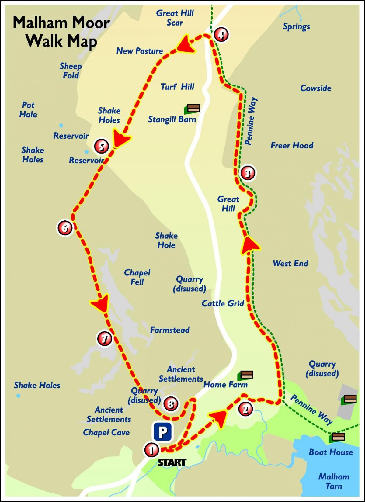
A circular walk on the Pennine Way and lower fell side, with rewarding views of Malham Tarn. It has sections on open moorland with no obvious path, so a map and navigational skills are required for walkers.
THE Pennine Way celebrates its 50th anniversary next month.
Its completion was marked with a gathering on Malham Moor on April 24, 1965.
And that is where we head for this week’s walk.
The Pennine Way - the UK’s first long-distance footpath - is 268 miles long, stretching from Edale in Derbyshire to Kirk Yetholm in Scotland.
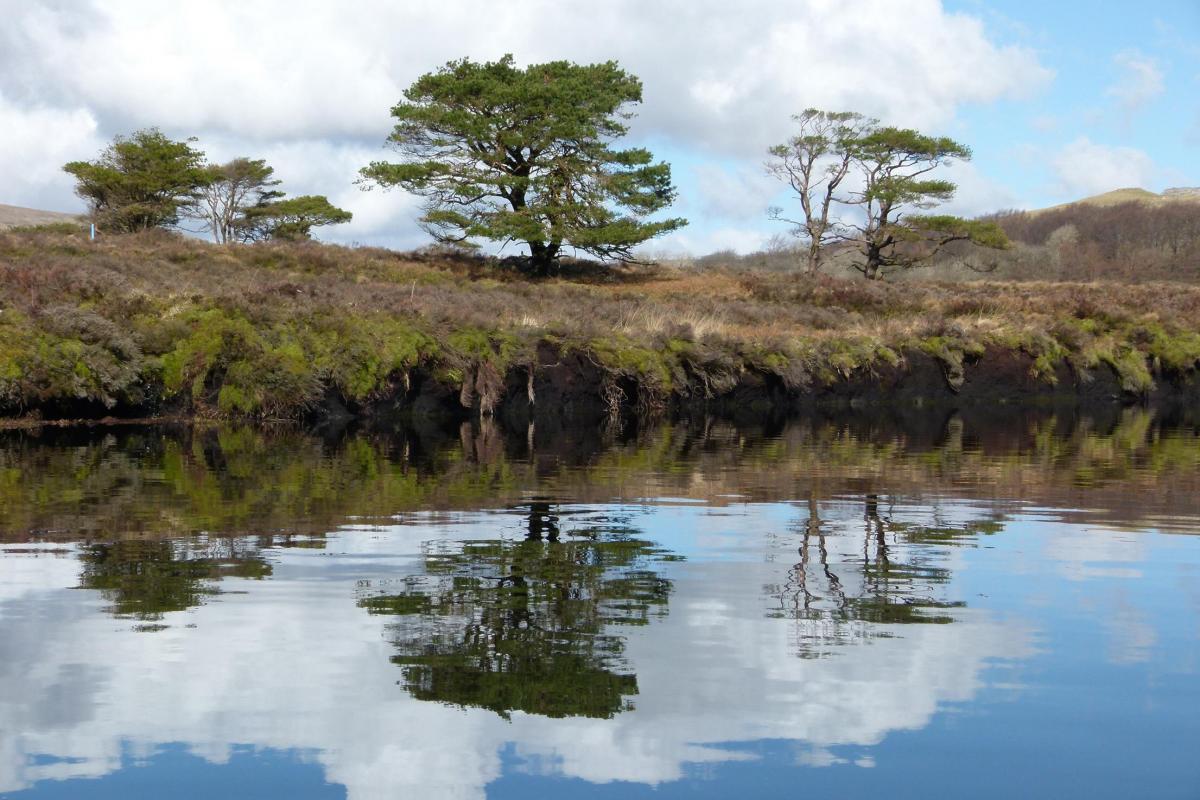
We pick it up near Malham Tarn - which is part of the internationally important National Nature Reserve and is home to a number of rare species, some of which are remnants from the last Ice Age.
It is 377 metres above sea level, making it the highest lake in England.
The estate is owned by the National Trust, which manages it in partnership with Natural England and the Field Studies Council.
The site also takes in Tarn Moss, a 15-feet-deep peat bog, which is estimated to be about 12,000 years old, Tarn Fen - one of the few remaining calcareous fens in Britain - upland hay and wild flower meadows, limestone pavements and an upland ash woodland.
It has a rich heritage of scientific interest dating back to the mid 1800s.
In fact there is evidence to suggest that Charles Darwin visited the Malham Tarn estate in the late 1800s to investigate the impact of sheep grazing on heather.
The walk was devised by the National Trust and was supplied to us by the Yorkshire Dales National Park Authority.
For more Dales walks, visit yorkshiredales.org.uk
Step by step
1. (GPS: SD 882 671) From the car park turn right and follow the road for 100m. Go through the gate on your left onto the unmade road. On your right is Tarn Moss - an important conservation area of fen and raised bog.
2. (GPS: SD 886 673) At the road junction turn right. After continuing past the NationalTrust Estate buildings, take the gate on your left, signposted ‘Pennine Way’.
3. (GPS: SD 885 684) Follow the Pennine Way, continuing past Great Hill. Look out for the variety of meadow flowers along this stretch in early summer.
4. (GPS: SD 884 691) When the Pennine Way meets the tarmac road, cross to the other side. Do not continue on the Pennine Way, but go through the gate on your left onto the way marked bridleway and follow this over three wall crossings.
5. (GPS: SD 878 684) At the fourth wall crossing look for little brown walker on a circular sign, which tells you that you are now entering Open Access land. Continue along the bridleway to the next wall crossing and go through the gate.
6. (GPS: SD 877 682) From the gate leave the bridleway and swing round to your left in a southerly direction, following the way-marked post in the direction of the wall. Go over the timber step stile in the fence and a step stone stile in the wall.
7. (GPS: SD 879 676) Continue downhill across the rough open pasture, on the well marked path, in a south easterly direction. Directly in front of you, as you continue on this route, is a rewarding view of Malham Tarn and the Nature reserve.
8. (GPS: SD 883 673) At the foot of the pasture, follow the path round to your left and through the gate. At the road turn right and continue until you arrive back at the car park.


Comments: Our rules
We want our comments to be a lively and valuable part of our community - a place where readers can debate and engage with the most important local issues. The ability to comment on our stories is a privilege, not a right, however, and that privilege may be withdrawn if it is abused or misused.
Please report any comments that break our rules.
Read the rules here